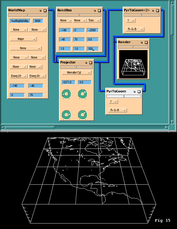
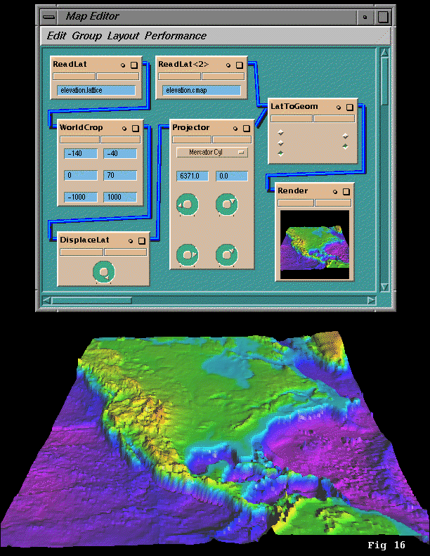
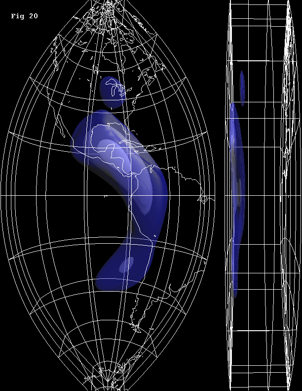
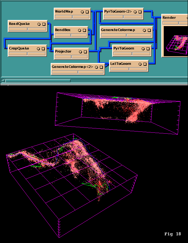
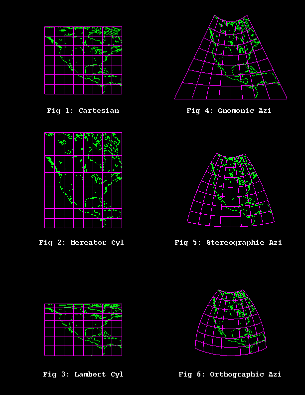
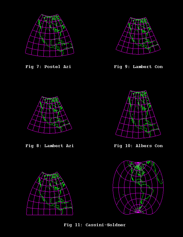
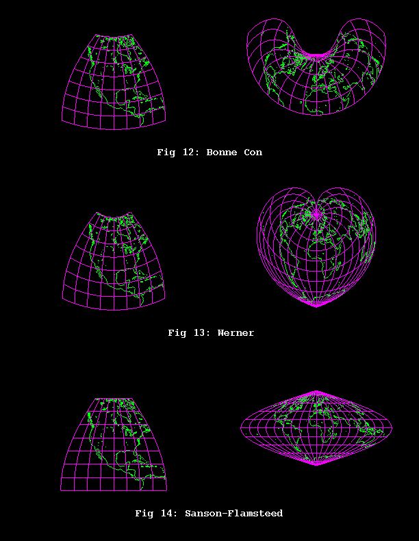
These modules were written in 1992 during an internship with Paul Morin and David Yuen of the Minnesota Supercomputer Institute. My coding skills have improved substantially since then, but this was production quality code at the time. As far as I know they are still useful. I would love to hear from anyone who is using the modules today.
